In August of 2015, I did three days of hiking in Rocky Mountain National Park, starting each day from the popular Bear Lake trailhead, which offers great access to a variety of beautiful alpine lakes and scenic overlooks, as well as wildlife spotting. I saw elk, marmots, many birds, and even a couple of moose during my time there (and I would have loved to see a bighorn sheep!).
I also did a number of scenic drives in the park on my fourth day, which are by themselves worth the cost of admission to the park (which is a very reasonable US $20 for a full week).
**To skip ahead to the pictures, click here for over 30 shots of RMNP.**
My Hikes in Rocky Mountain National Park
The below are the routes I took, as well as a bit of data per hike, and my general feelings about each one.
Hike #1: Bear Lake trailhead to Emerald Lake (via Nymph Lake and Dream Lake)
Starting Elevation: 9,475 Feet
Highest Elevation: 10,110 Feet
Total Distance: 3.5 miles roundtrip
Difficulty: Easy
This is probably the most congested and touristed trail in Rocky Mountain National Park, aside from the easy loop that goes directly around Bear Lake itself (a hike that requires almost no elevation gain).
This hike took me past Nymph Lake (bland by comparison to the subsequent lakes), then Dream Lake (nice), and finally Emerald Lake.
Emerald Lake is really quite stunning, but the amount of people I was surrounded by on the trail (noisy people that were feeding the pesky local chipmunks at that!) sort of spoiled it for me. I preferred other paths in Rocky Mountain National Park for this reason.
After reaching Emerald Lake, I returned to Bear Lake trailhead on the same path I walked on the way in.
Hike #2: Bear Lake trailhead to Odessa Lake, The Pool, Fern Lake – terminating at Fern Lake trailhead
Starting Elevation: 9,475 Feet
Highest Elevation: 10,697 Feet
Total Distance: 9.2 miles total (one-way hike)
Difficulty: Strenuous
I undertook this hike on the same day as my hike from Bear Lake Trailhead to Emerald Lake, and ended up showing up at Odessa Lake at sunset due to my late start. This resulted in over two hours of hiking in complete darkness in order to reach my car at the Fern Lake trailhead. It‘s a good thing I always carry a headlamp and plenty of water!
That said: the approach to Odessa Lake is absolutely gorgeous. I would highly recommend this hike to anyone that feels comfortable with a near-10-mile hike at elevation.
Hike #3: Bear Lake trailhead to Alberta Falls, The Loch, and Timberline Falls – terminating at Bear Lake trailhead
Starting Elevation: 9,475 Feet
Highest Elevation: 10,660 Feet
Total Distance: 8.1 Miles (roundtrip)
Difficulty: Strenuous
The path from Bear Lake trailhead to Alberta Falls is probably the second most touristed path in RMNP. I saw trash multiple times on the path, and had to admonish some “hikers” to stop carving their names into the poor trees that line the path. Elevation gains on this path are not extreme, and hikers of pretty much any experience level can make it to Alberta Falls.
Alberta Falls is a nice scenic falls which had a decent amount of water flow at the time I visited, and is pictured below. Once you hike BEYOND Alberta Falls, you get out of range of many of the tourists, which is also nice.
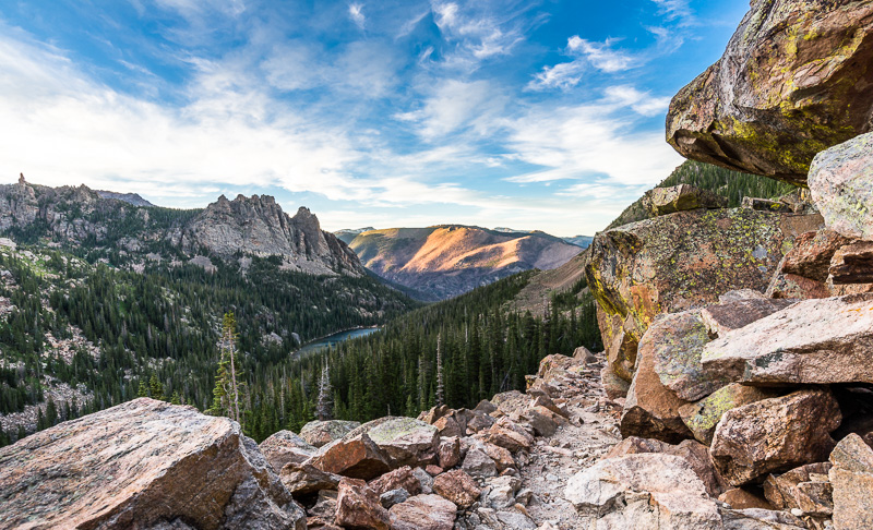
The Loch is a fantastically beautiful alpine lake and should not be missed. On the afternoon I visited here, the weather was overcast and the lake was quiet. Pics below.
Hiking deeper in the park and further uphill took me to Timberline Falls, which gave a nice view of the valley in which lies The Loch / Loch Vale. This required a small amount of scrambling uphill on wet rocks, but was not difficult.
Should I have continued on further, I would have reached Sky Pond – which I have learned is many people’s FAVORITE THING in RMNP. I should have continued on, but I hesitated due to time constraints (I was hiking late in the day and was afraid of missing the last shuttle bus back to my car!). Next time, next time.
Note that the hike to Alberta Falls usually originates from Glacier Gorge trailhead. Start there instead of Bear Lake trailhead if you would like to save yourself a bit of time.
Hike #4: Bear Lake trailhead to Emerald Lake, and onward to Lake Haiyaha and Mills Lake – terminating at Bear Lake trailhead
Starting Elevation: 9,475 Feet
Highest Elevation: 10,240 Feet
Total Distance: 6.8 Miles (approx)
Difficulty: Moderate
I did the hike to Emerald Lake hike once again to see if I could get some different angles or different shots – but I should have shown up at SUNRISE to get different light instead. From Emerald Lake, I proceeded to Haiyaha Lake, and onward to Mills Lake. The weather was very grey and rainy for these hikes that day. I did not reach Black Lake that day, which is about 2.6 miles further up the path. Ran out of time again!
These hikes can be further investigated at the Rocky Mountain Hiking Trails website, which describe each hike in greater detail than I do here. Stats listed above are pulled from their helpful tables on their page.
I wore/brought along the following for my day hikes:
Backpack + Camera Gear
- LowePro Photo Sport 200 AW photo backpack (comes with its own rain cover, which I used frequently)
- Nikon D610 full frame DSLR
- Sirui T-1205x tripod + Sirui G10 ball head
- Nikkor 18-35mm f/3.5-4.5 (with lens hood)
- Nikkor 50mm f/1.8G (with lens hood)
- Nikkor 70-200mm f/2.8 VR II (with lens hood)
- 4-stop ND filter (77mm filter thread)
- Circular Polarizing Filter (77mm filter thread)
- Multiple lens cleaning cloths
- LensCoat “RainCoat” for covering camera in rainy conditions
The Usual Stuff
- 2-3 liters of water per day
- Snacks
- Rain shell (it rained almost every day)
- Sweater (it was cold in the late afternoons)
- Hiking boots (trails are for the most part in great condition, but a good pair of comfortable waterproof boots never hurt anyone)
- Headlamp (I carry a headlamp or torch on EVERY hike, including day hikes!)
- Notable omission: first aid kid. I should have been carrying one of these while hiking!
Additional tips for those hiking from Bear Lake trailhead:
Parking is limited at Bear Lake trailhead, so if you are arriving late morning or after, you may want to park at the “Park and Ride”, and then take one of the frequent shuttle buses up to the Bear Lake trailhead from there. Just make sure you don’t miss the last shuttle back to the Park and Ride at the end of the day!
Also: there are water fountains at the Bear Lake trailhead for refilling water bottles, as well as bathrooms (pit toilets).
Lastly: I recommend speaking with a park rangers prior to every single hiking day if possible. If bad weather is expected that day, they may help you pick appropriate trails to avoid those conditions (e.g. don’t hike to the summit of Flattop Mountain if lightning is expected!).
Nice Drives in Rocky Mountain National Park
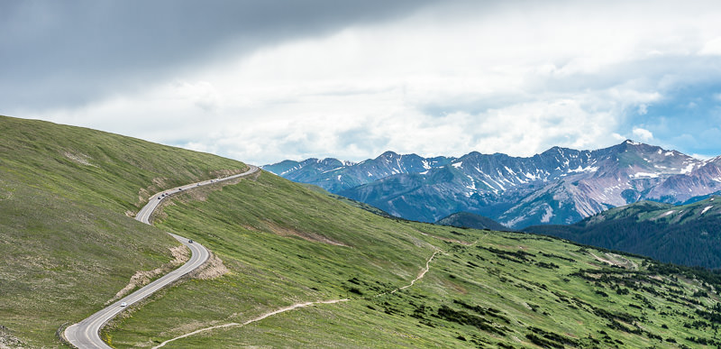
Trail Ridge Road
Trail Ridge road is a fully paved road that stretches between Estes Park, Colorado and Grand Lake, Colorado. The road reaches its maximum elevation at 12,183 feet, near Fall River Pass, and holds the title of “highest continuously paved road in the US”. Trail Ridge Road crosses the Continental Divide at Milner Pass, elev. 10,120 feet.
Views are stunning from Trail Ridge Road, and I found myself driving it on three separate occasions, at different times of day. I couldn’t seem to get enough of the dramatic switchbacks that make you feel like you’re at the top of the world, the tundra with its yellow wildflowers, the wandering herds of elk, and the chance of seeing a bit of alpenglow if the weather was right in the evenings.
Old Fall River Road
Old Fall River Road is an unpaved road that leads from the east side of Rocky Mountain National Park to the Fall River Pass, where it terminates and merges traffic into Trail Ridge Road (via a parking lot and gift shop, albeit).
Old Fall River Road is 11 miles long, has no guard rails, and maintains a speed limit of 15 miles per hour. It’s more a “scenic route” than a road you’d want to commute on. This road opened in the early 1920s and offered the first road access to the high country of Rocky Mountain National Park.
Driving Old Fall River Road is free with your RMNP admission, and you can do it in any car. I drove it in a rented Toyota Camry, in light rain, with zero problems and very little traffic.
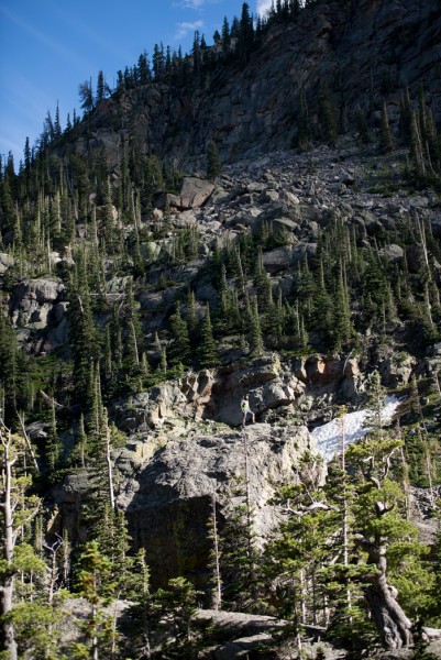
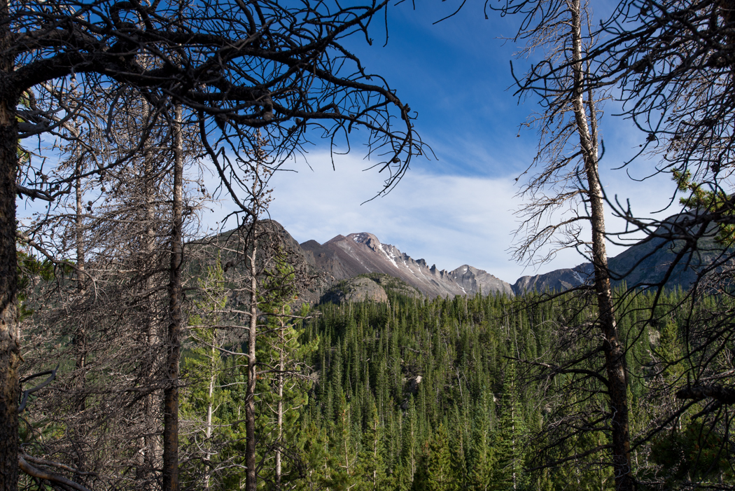
Selected Pictures of Rocky Mountain National Park
Some of my favorite shots from my trip to RMNP are below, in chronological order. Hope you enjoy!
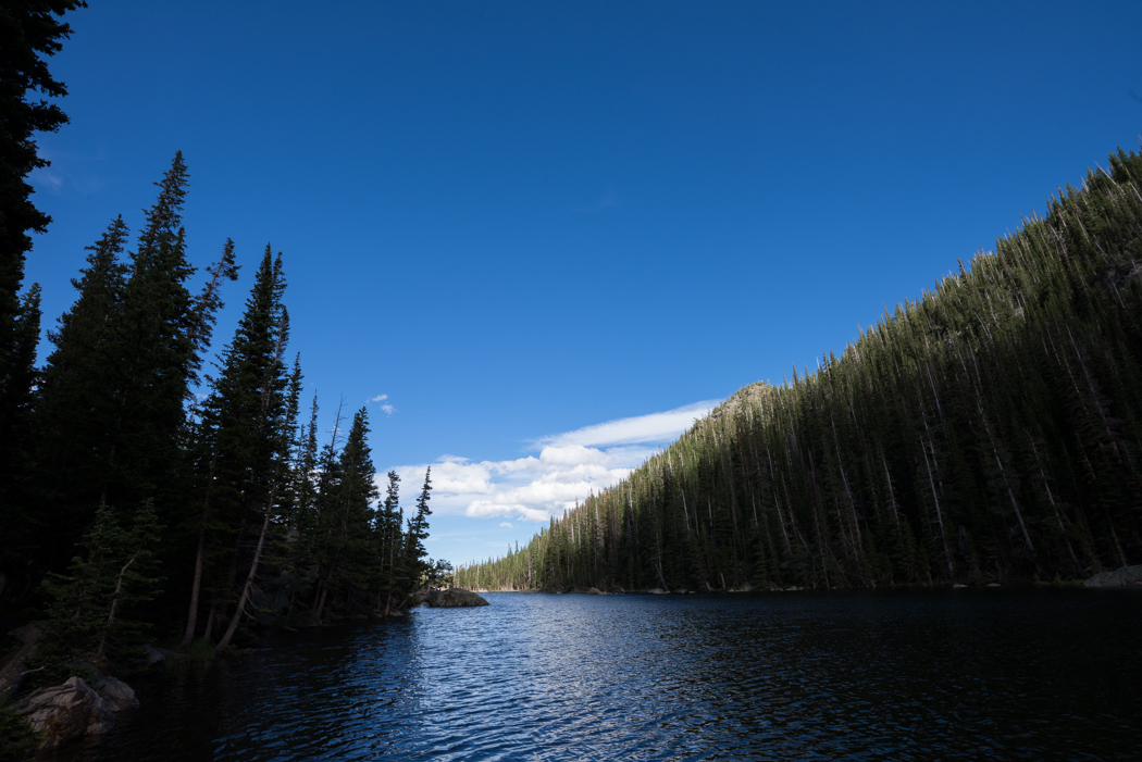
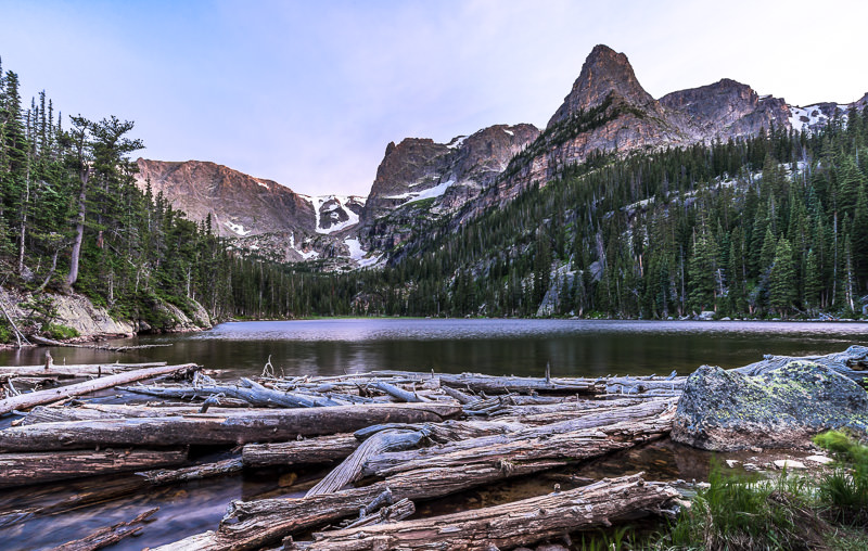
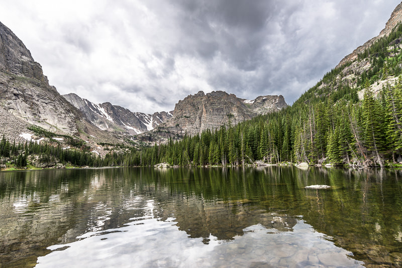
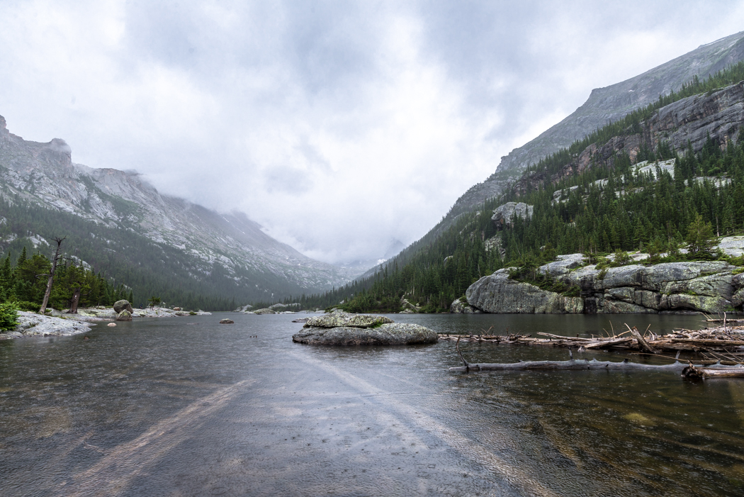
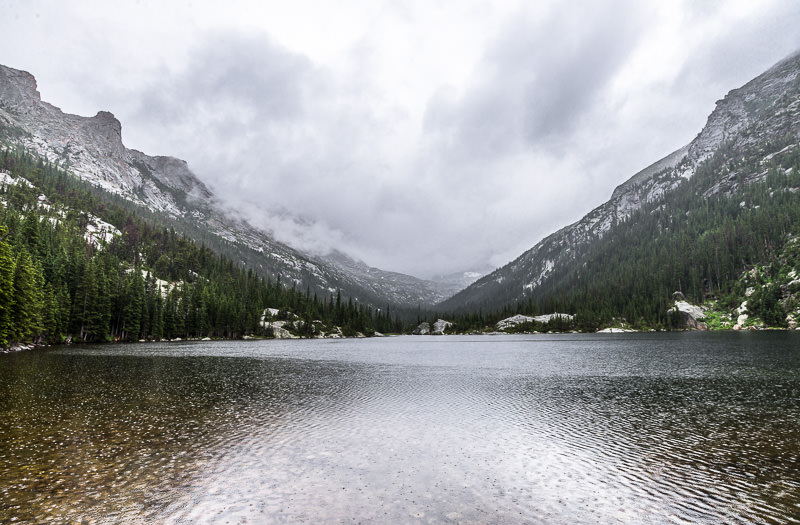
Dream Lake.
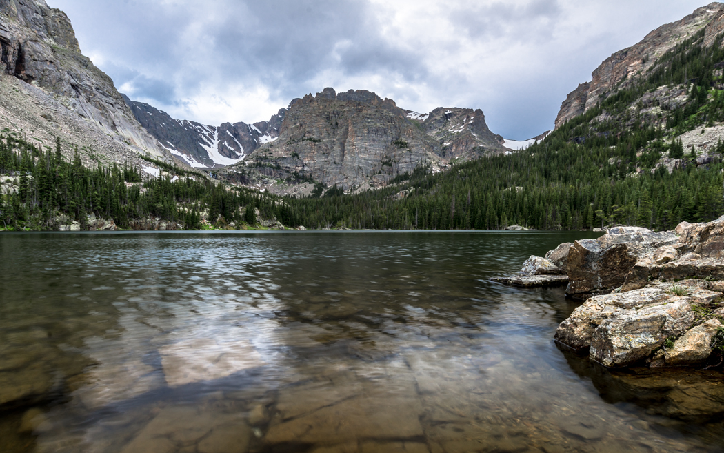
Emerald Lake.
A lone hiker/climber suns himself on a boulder. Can you see him?
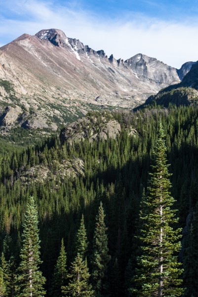
Long’s Peak (14,259′) and Glacier Gorge, as viewed from near Dream Lake.
Long’s Peak (14,259′) and Glacier Gorge.


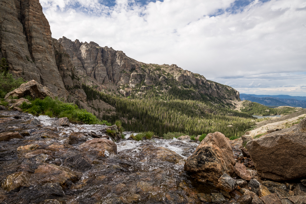
the trail above Odessa Lake.
Odessa Lake at Sunset.
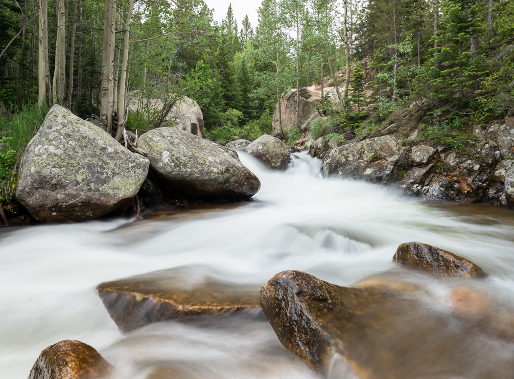
a stream downhill from Alberta Falls.
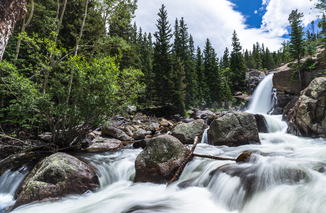
Alberta Falls.
just upstream from Alberta Falls.
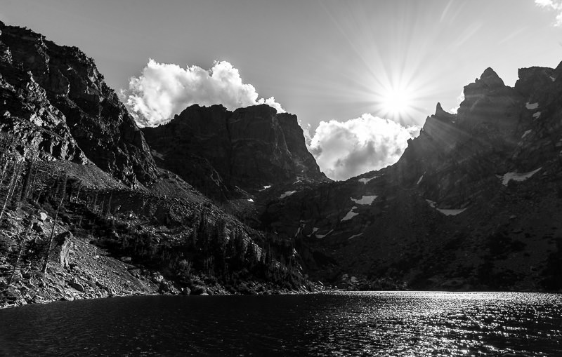
The Loch.
The view toward The Loch, from Timberline Falls.
The Loch.
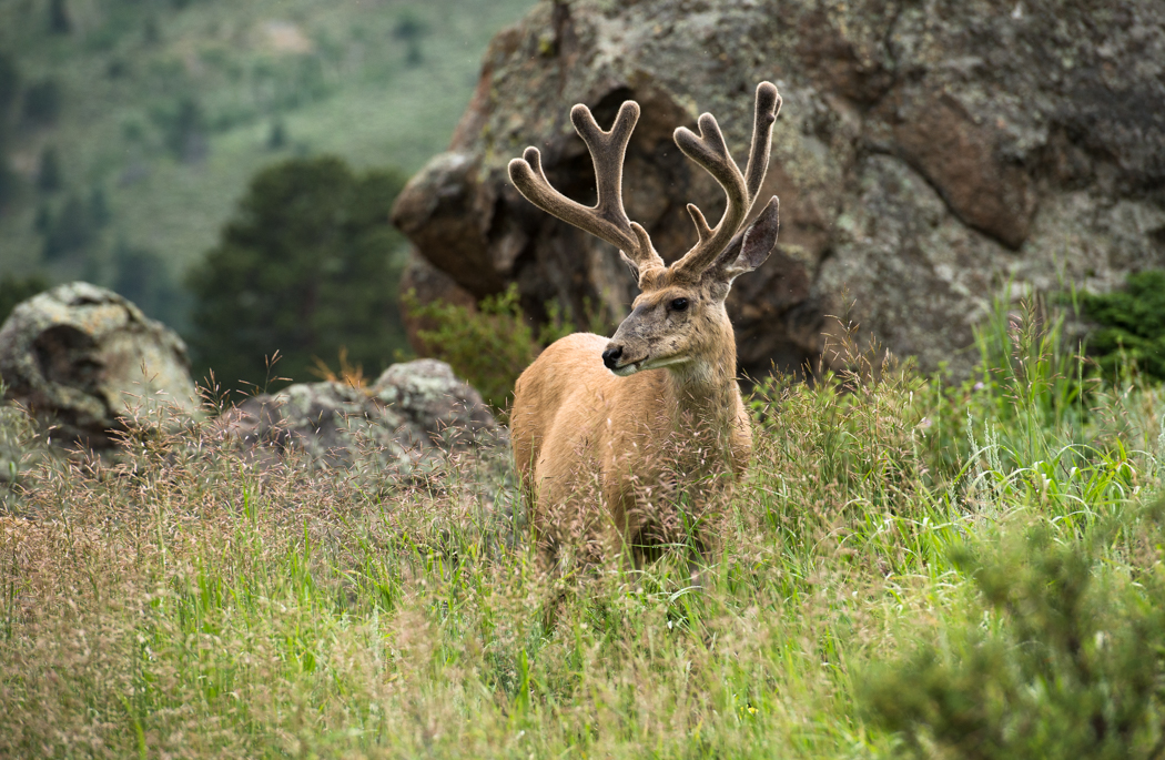
Male mule deer.

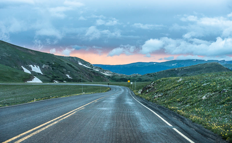
atop Trail Ridge Road at sunset.
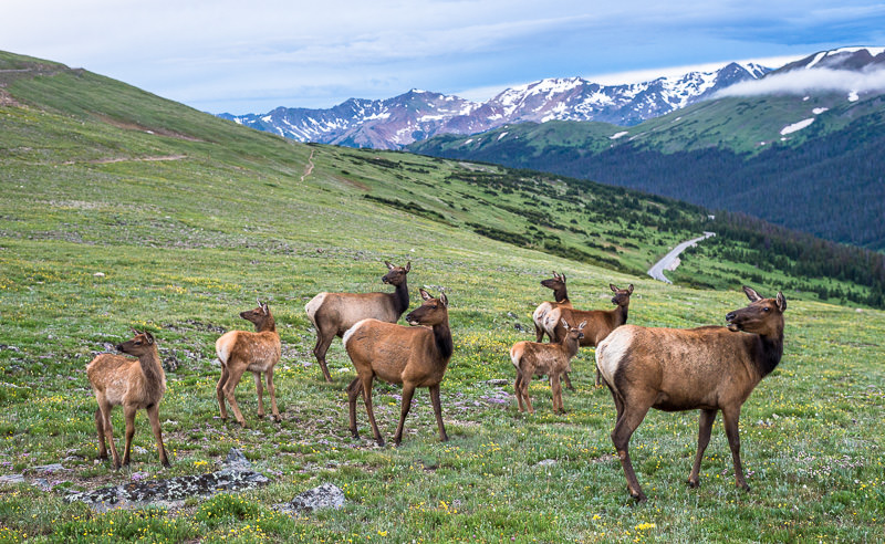
Gang of Elk atop the Continental Divide, Never Summer mountains to rear. Rocky Mountain National Park, Colorado.
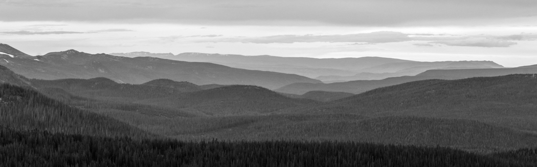
looking east from the Continental Divide. Trail Ridge Road.
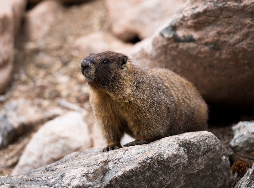
yellow-bellied marmot.
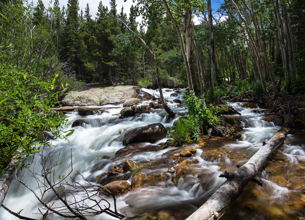
Mills Lake.
Mills Lake in the rain.
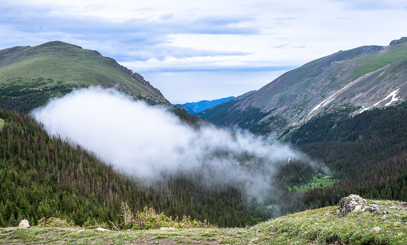
strange ground fog fades into a hillside near the top of Old Fall River Road.
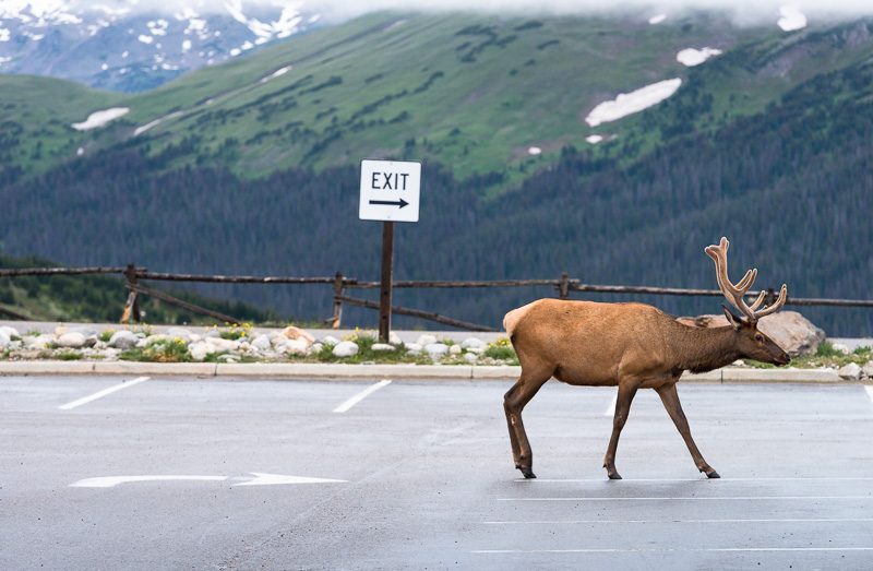
Elk-xit.

Trail Ridge Road and the Never Summer Mountains.
Thanks for reading/viewing!