On September 27 and 28 of 2014, I trekked/climbed to the summit of Volcán Tajumulco (13,851 feet / 4,222 m above sea level) – the highest point of elevation in all Central America.
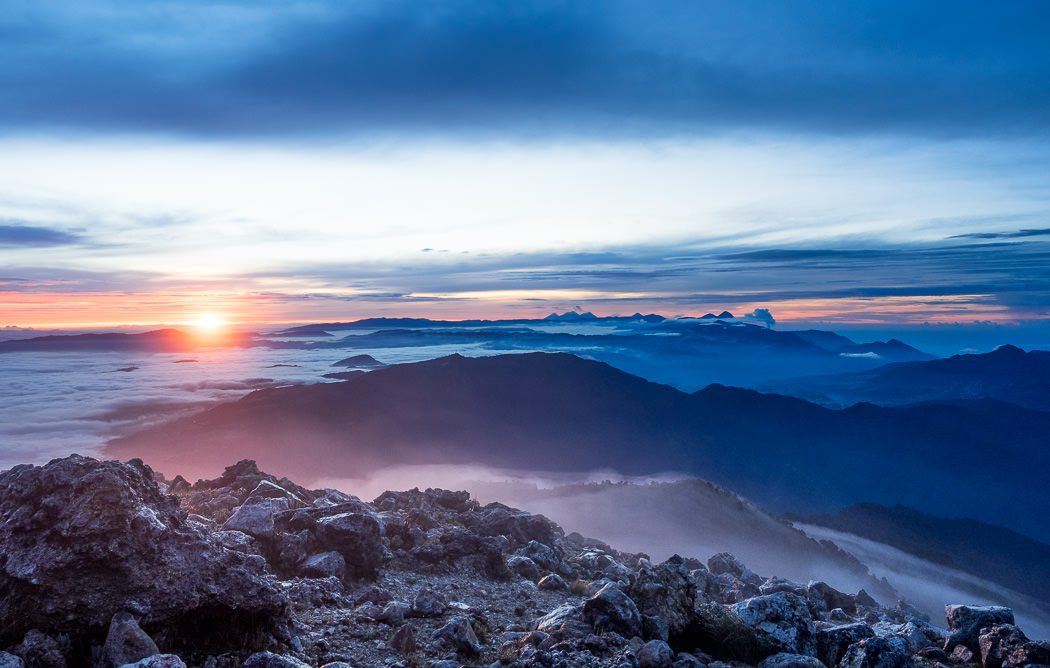
The primary reason people embark on this hike, aside from the self-evident bragging rights of reaching the “highest point” of anything/anywhere, is for the often impressive sunrise and vista over the volcano-dotted landscape of western Guatemala.
The trek was a two-day affair arranged through Xela-based trekking company Quetzaltrekkers. Total costs per person ran 500 Guatemalan Queztales (about $65.00 US), which covered all transport, any/all trekking equipment needed for the hike (sleeping bags, additional warm clothing as needed, tents, etc), guide fees and all food for the duration.
Our first day of the trek began with public transport via camioneta (chicken bus) from Quetzaltenango (Xela) to San Marcos for transfer to another camioneta that would take us to trailhead, at the base of Tajumulco (around 3.5 hours total in buses). From there, we ascended Tajumulco for approximately five hours. The plan was to camp for the night in tents just below the summit of Tajumulco, at around 4000 meters (13,000 feet) of elevation.
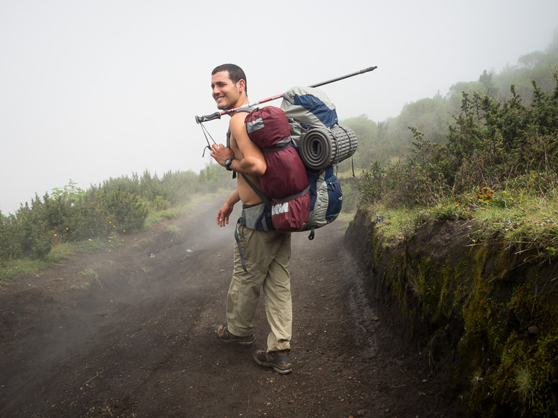
Each of us in our group of ten carried 4-5 liters of water (enough for both days) and split the weight of shared resources like food, tents, first aid kits and auxiliary camping supplies between the backpacks of the group. Though I didn’t have the chance to weigh my backpack, I would guess it came it at around 16-18 kg (35-40 lbs) when fully loaded including my usual extra ration of camera gear. Not backbreaking, but noticeable.
On day two, we ascended the final 45 minutes to the summit, took in the sunrise, and returned to our encampment for breakfast and to break camp. Descending back to the initial trailhead only took two hours of hiking. Quick. Then it was time for lunch and return transit to Xela.
Note: Though the Tajumulco trek was not an extremely difficult nor technical hike, it did present its challenges. Altitude sickness was a significant issue for multiple hikers in our group as elevation increased. Accordingly, I recommend that persons interested in summitting Tajumulco acclimatize themselves to altitude prior to signing on for this hike. Also, our hike was also quite wet and quite cold – appropriate clothing, footwear and rain gear were necessary.
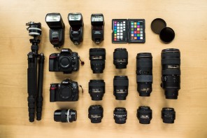
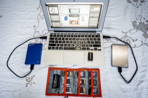
All below photos were shot on the Olympus OM-D E-M1, most often paired with the Olympus M.ZUIKO DIGITAL ED 12-40mm f/2.8.
Tajumulco Trek: September 28th, 2014 (Day 2 of 2)
4:36 AM
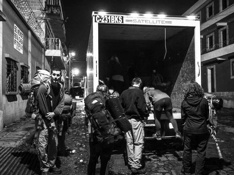
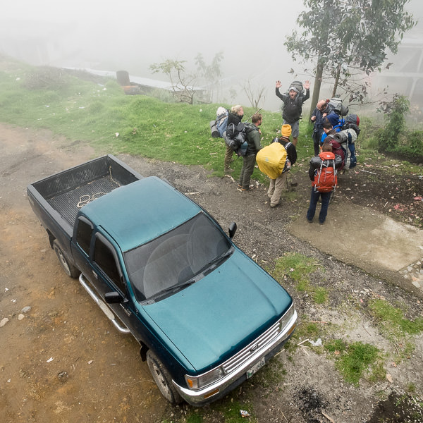
Outside Quetzaltrekkers’ offices, our trekking group climbed into the back of a box truck for transport to Xela’s bus terminal.
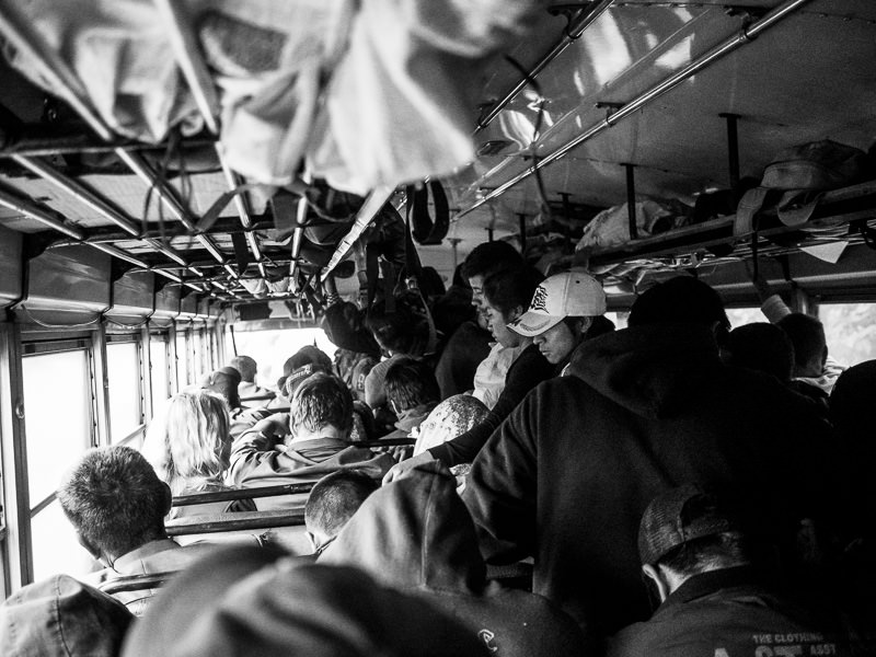
6:36 AM
Public transit: aboard a jam-packed camioneta from Xela to San Marcos.
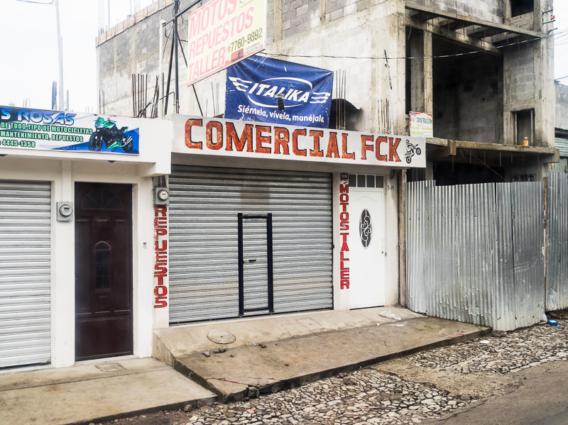
7:01 AM
A local business near San Marcos.
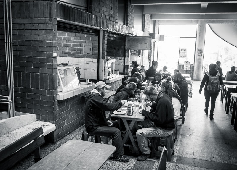
7:30 AM
Eating breakfast in a comedor next to the bus terminal in San Marcos. Desayuno tipico.
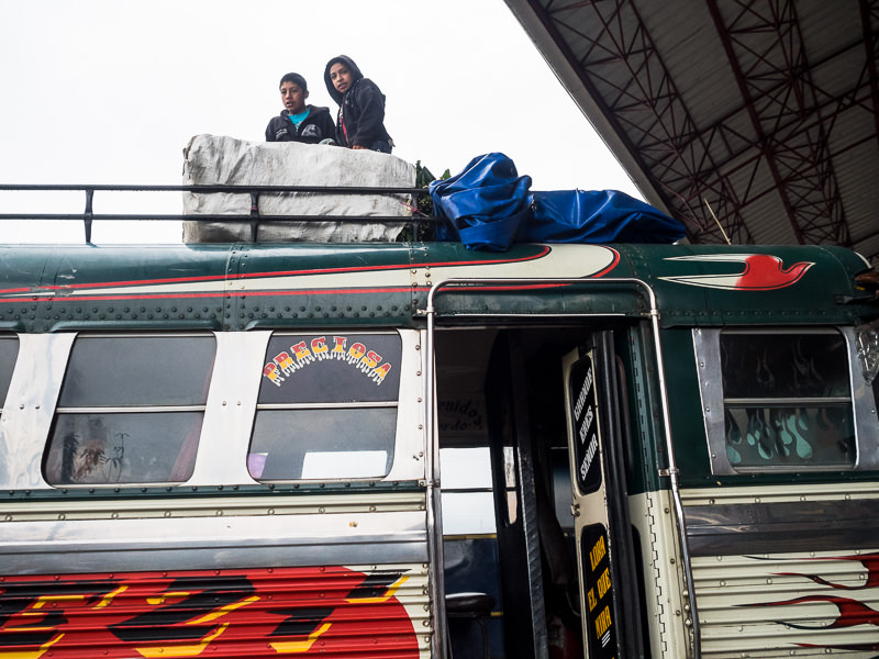
8:07 AM
Young dudes loading the top of a camioneta with produce at San Marcos’ bus terminal.
8:13 AM
You thought your backpack was heavy?
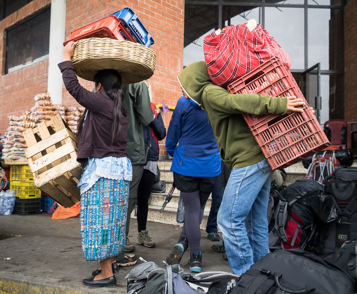
San Marcos, Guatemala.
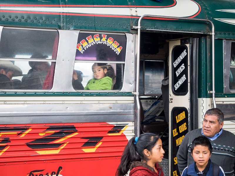
8:21 AM
Preciosa.
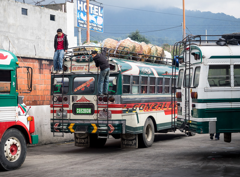
8:44 AM
Departure. Hang on.
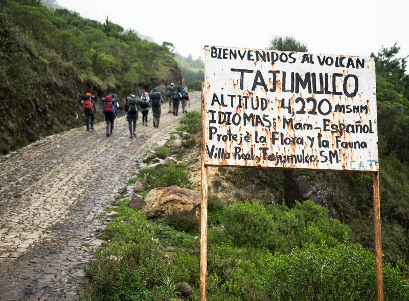
10:12 AM
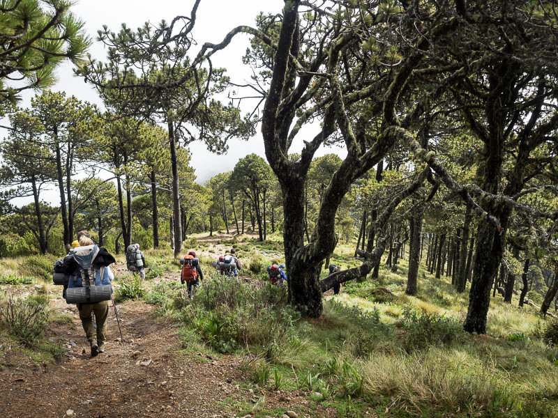
The hike begins at Tajumulco’s base, elevation approximately 3,050 meters. Many people in his region speak the Mayan language of Mam and do not speak Spanish.
10:25 AM
Gradual inclines to begin.
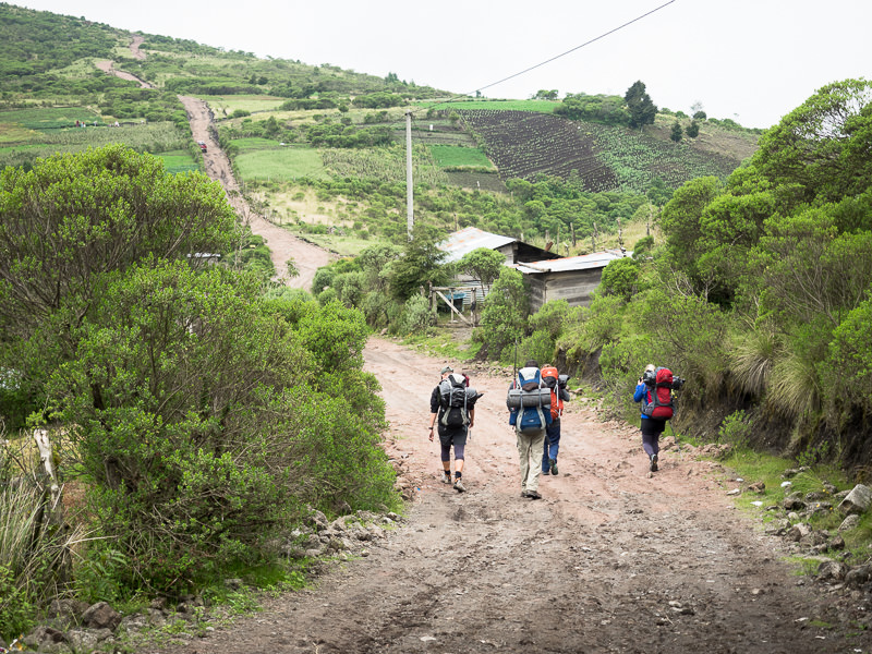
10:29 AM
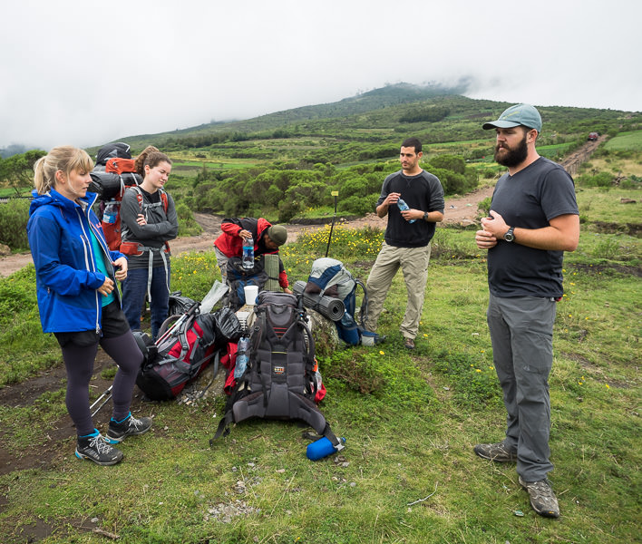
Break/meeting prior to ascending further, into the thick fog ahead.
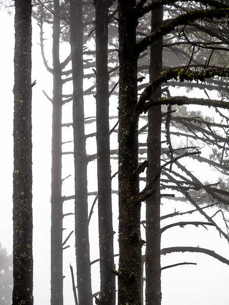
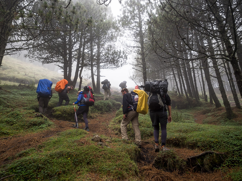
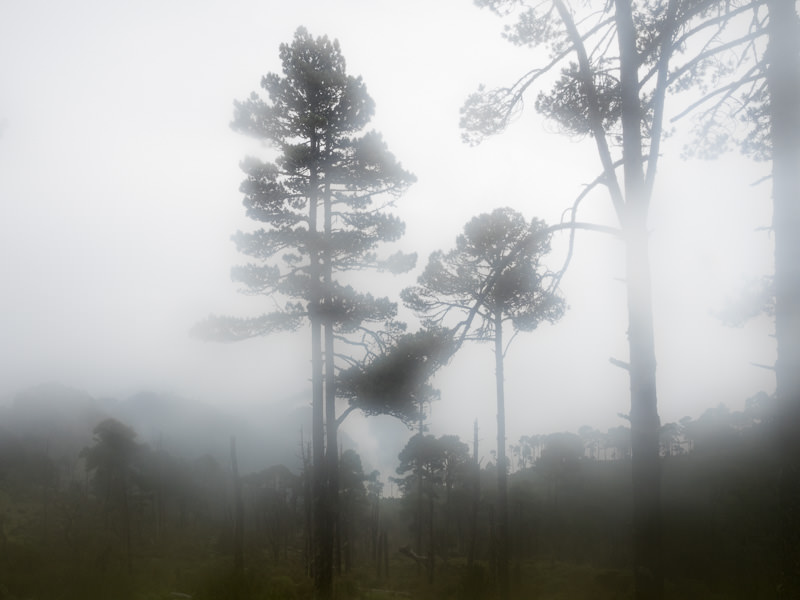
12:05 PM
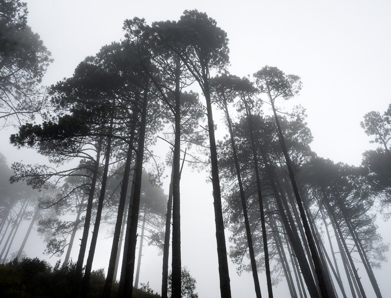
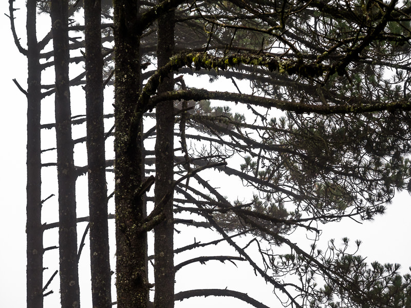
Trees in thick fog.
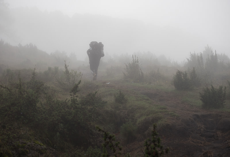
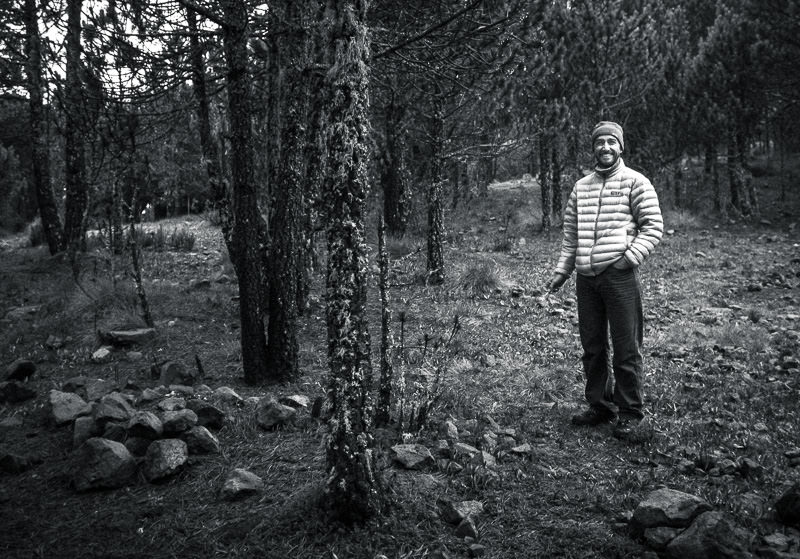
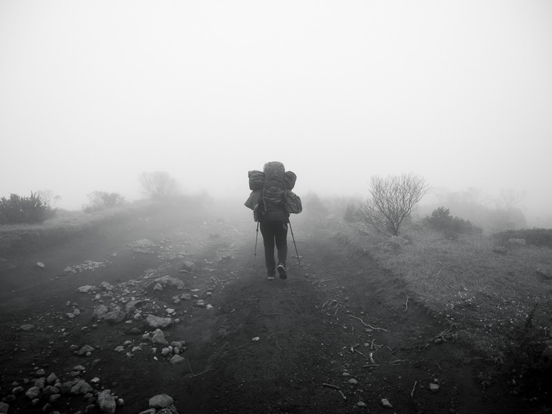
12:07 PM
Hiker in thick fog.
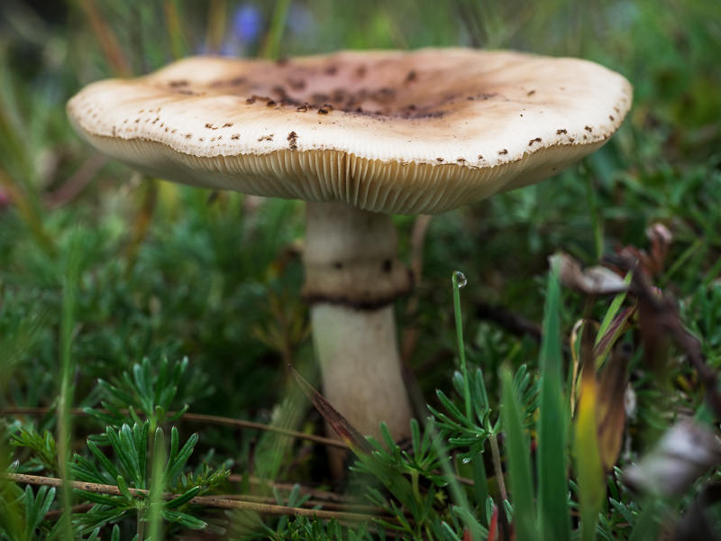
1:07 PM
Local funghi.
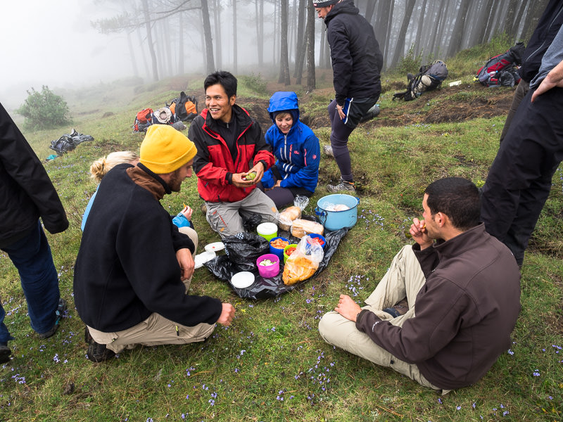
1:08 PM
Lunch break – vegetable sandwiches and chips. Our guide, Cesar, hosts.
1:40 PM
Continuing upward.
1:58 PM
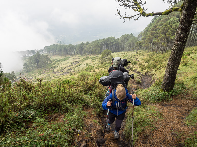
Up further, into persistent, cold rain.
2:07 PM
Struggling to stay dry in rains that would continue for almost four more hours (and staying dry is important – temperatures often drop below freezing near the summit!).
2:44 PM
Strange, misty inclines near the location of our encampment for the night.
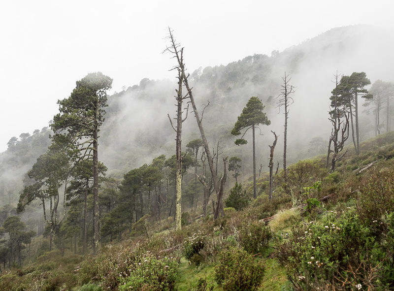
2:51 PM
By this point, everything was wet, including my camera and lenses, so I stopped shooting until we made camp.
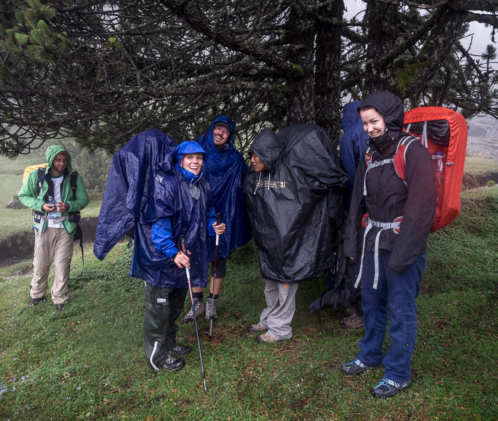
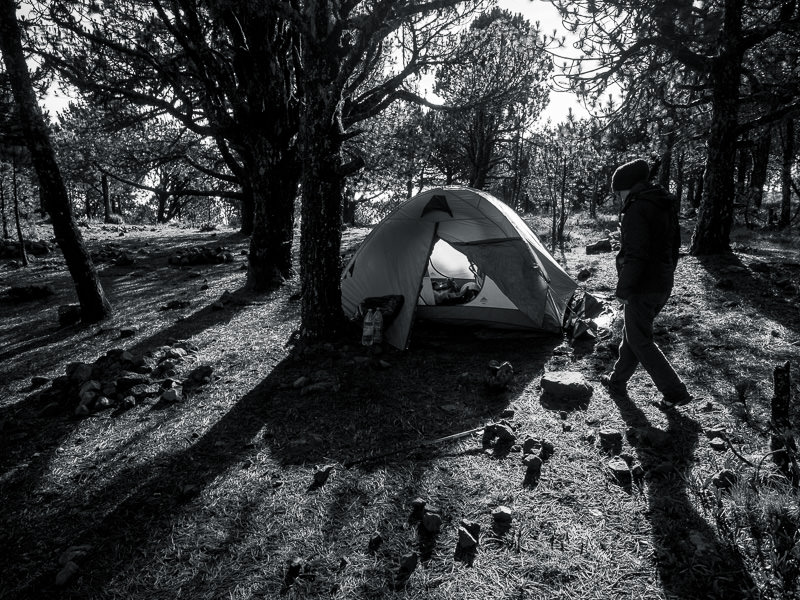
6:09 PM
After arrival and camp setup (and the end of the afternoon rains), Pascal, of Switzerland, enjoys a cigarette at base camp.
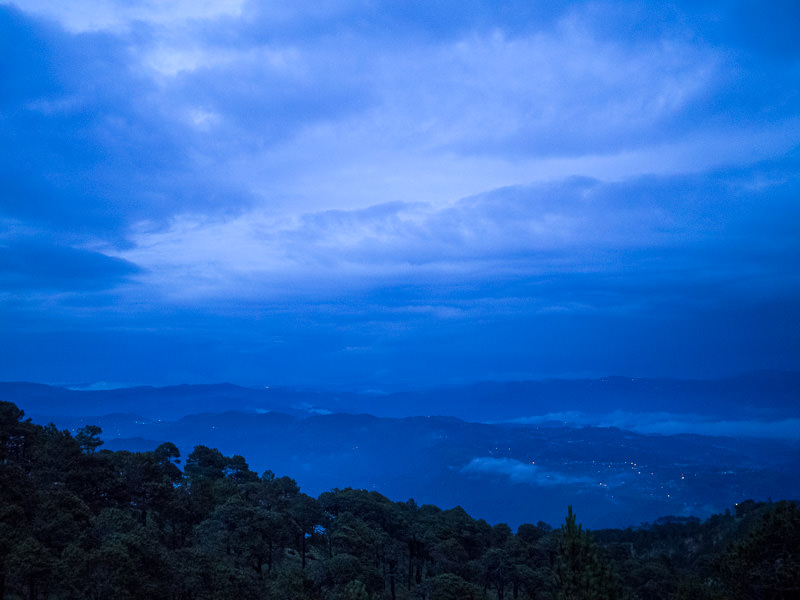
6:14 PM
Near sunset, from base camp, just below the summit of Volcán Tajumulco.
Tajumulco Trek: September 28th, 2014 (Day 2 of 2)
4:00 AM
Wake up time to climb the final bit to Tajumulco’s summit (NOT PICTURED). We began climbing around 4:45 AM and arrived at the summit about 45 minutes later.
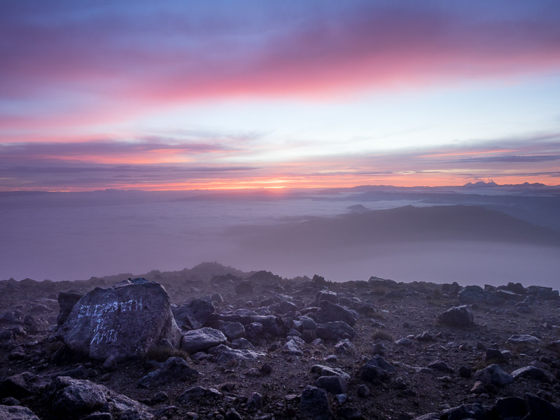
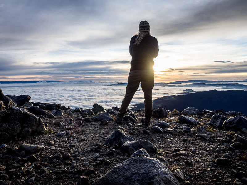
5:46 AM
The view from Tajumulco’s summit as sun begins to crest over the eastern horizon. The rock tagged “ELIZABETH TE AMO” (Elizabeth I love you) has surely been made famous in Tajumulco sunrise pictures. I’d prefer it wasn’t there at all – Elizabeth, I don’t love you.
5:53 AM
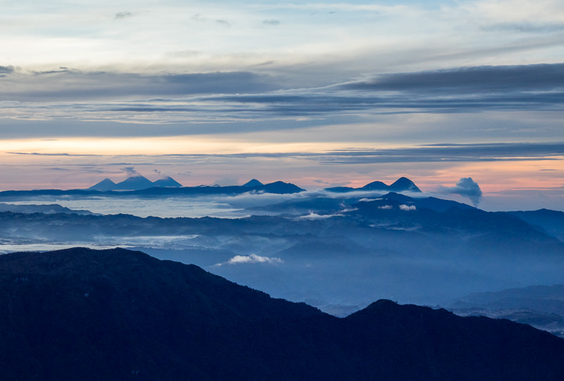
A jagged horizon of volcanoes and misty mountain ridges.

6:02 AM
A closer look at the horizon. Volcánes Agua, Acatenango, Fuego, Atitlán, Santa María and on the far right, an eruption of Santiaguito.
6:06 AM
Taking it all in.
6:08 AM
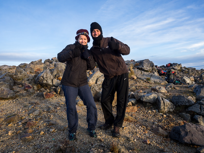
My tent-mates of the previous night – Johanna of Austria and Almog of Israel.
6:13 AM
Our trekking group poses at the summit. Left to right: myself, Alexa, Almog, Johanna, David, Barbara, Niko, Cesar (our guide), Pascal, Julius. Yeah, I’m wearing shorts (my pants were still wet from the previous day!).
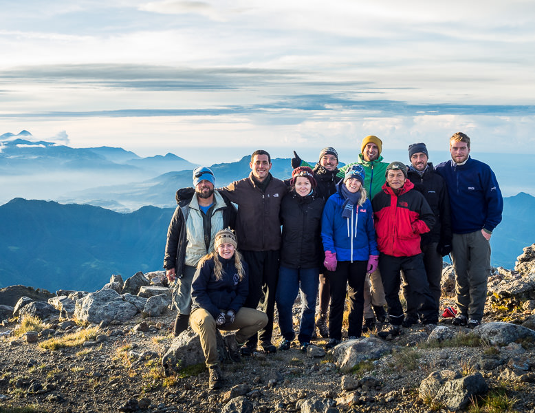
Summit of Volcan Tajumulco, Guatemala.
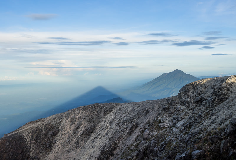
6:19 AM
The defined, long shadow of Tajumulco stretches westward, to the left of Volcán Tacaná, into Mexico, and toward the Pacific Ocean.
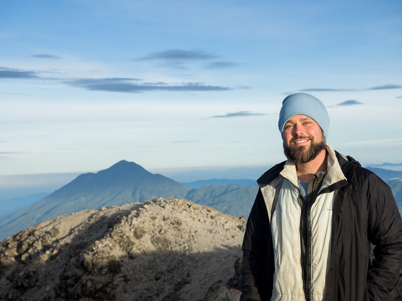
6:30 AM
Me, at the highest point of elevation in Central America, in borrowed hat and jacket.
6:49 AM
Soon enough, it was time to leave the summit to return to base camp for breakfast and to break camp.
6:55 AM / 7:21 AM
The way down.
7:33 AM
Last looks at our four-man tent before breaking camp.
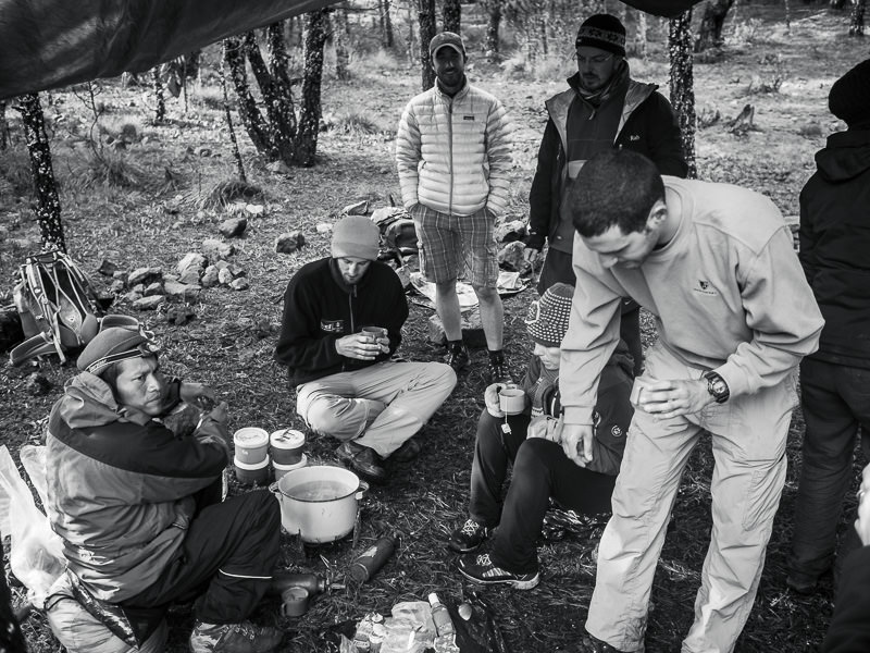
7:54 AM
Desayuno with the gang.
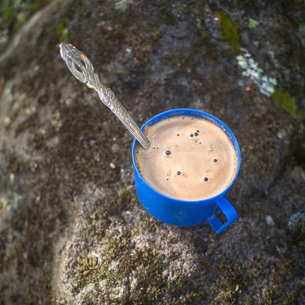
7:55 AM
Half coffee, half hot chocolate.
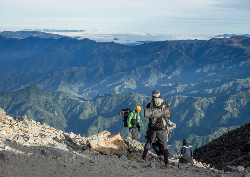
9:20 AM
After camp was broken and loaded into our packs, we began the hike back to the trailhead.
Volcan Tajumulco, Guatemala.
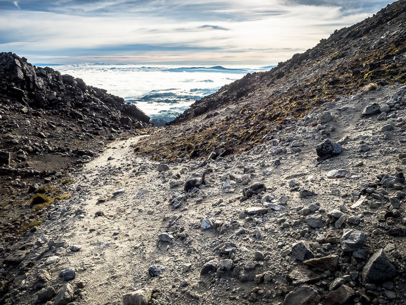
9:27 AM
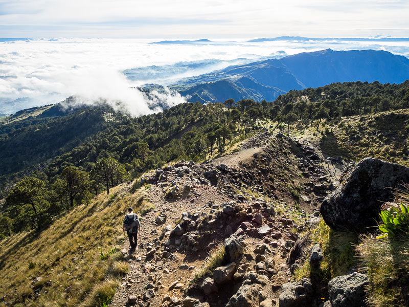
There’s something special about being above the clouds.
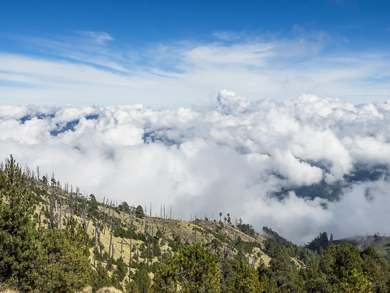
9:34 AM
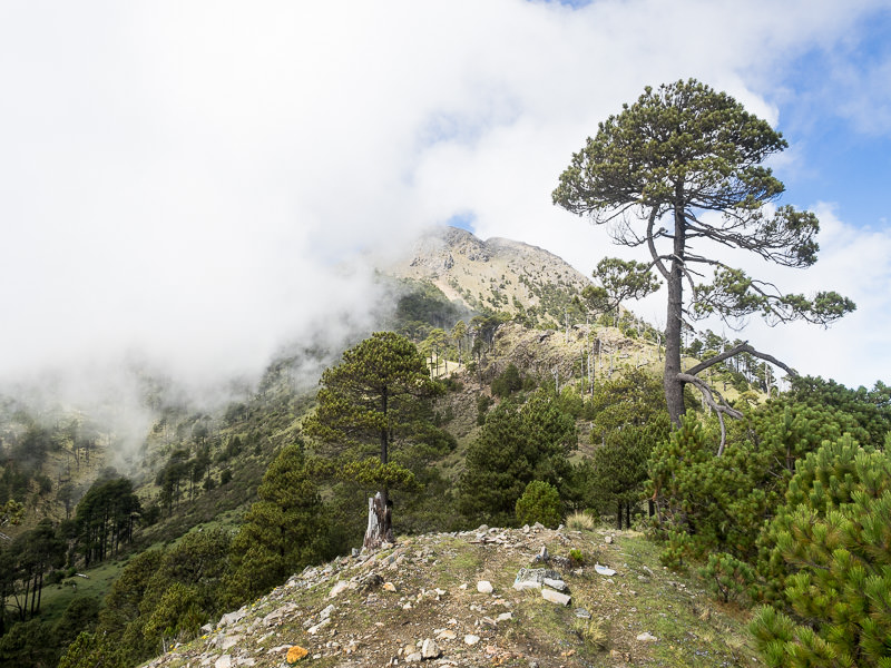
Looking back at the summit of Tajumulco from below.
9:41 AM
This would be my last look at the summit – heavy fog rolled in immediately after this shot and obscured the mountain behind and the trail ahead. Fortunately, no rains came with them.
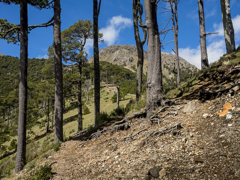
10:43 AM
Emerging from the high-elevation pine forests into a scrubbier landscape.
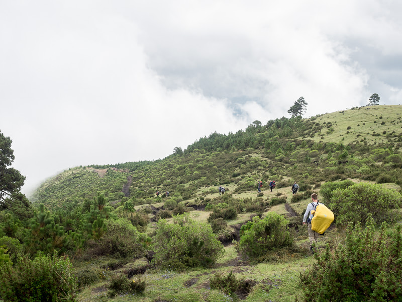
10:47 AM
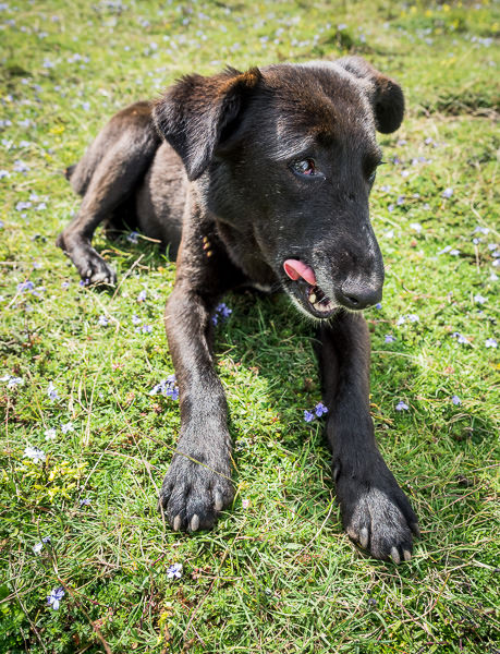
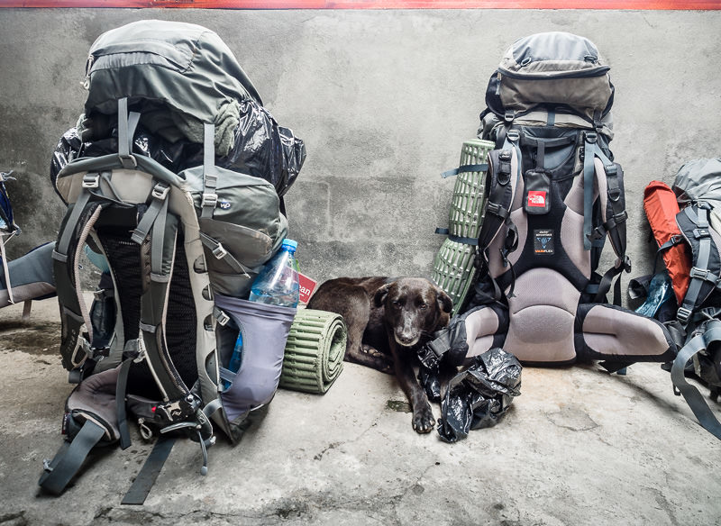
Doris the dog. She spends the entire hike with the trekking group just so she can eat leftover spaghetti for dinner. Well earned.
10:50 AM
Almog couldn’t figure out if he was hot or cold. Nor could the rest of us – the conditions in the mountains changed frequently and dramatically.
10:53 AM
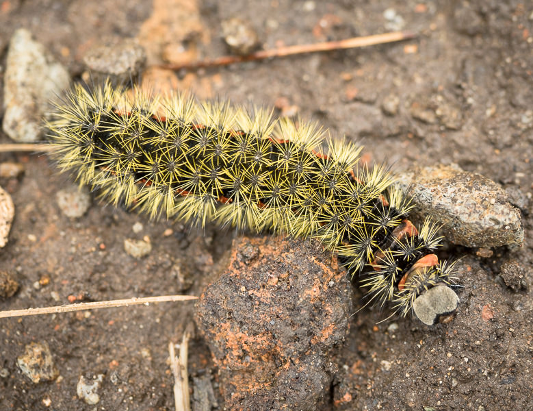
Colorful caterpillar, found underfoot.
11:00 AM
Nearly back to the trailhead, hiking in poor visibility.
11:39 AM
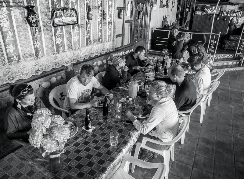
Doris waits with our packs while we lunch at a local restaurant near the trailhead.
11:43 AM
Pescado frito and cold beers.
12:36 PM
Packs back on after lunch, we head for the bus stop for return transit to San Marcos, and onward to Xela.
1:58 PM
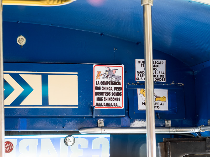
A sign inside the camioneta that would take us from San Marcos to Xela. “The competition fucks with us, but we are badasses, hahaha” (more or less)
2:00 PM
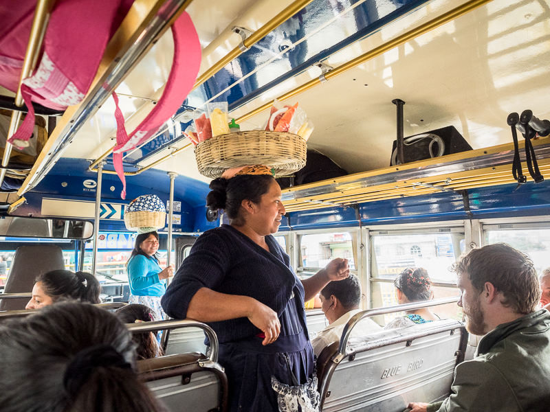
Food parade aboard the camioneta back to Xela.
4:00 PM
Arrived back in Xela (NOT PICTURED). Walked from Minerva bus terminal back to Quetzaltrekkers for equipment return, and then back to lodgings for a much needed shower and nap.
Thanks for reading! If you’re interested in another post about climbing volcanos in western Guatemala, check out my write up on How To Summit Guatemala’s Volcán Santa Maria for Fifty Cents.